
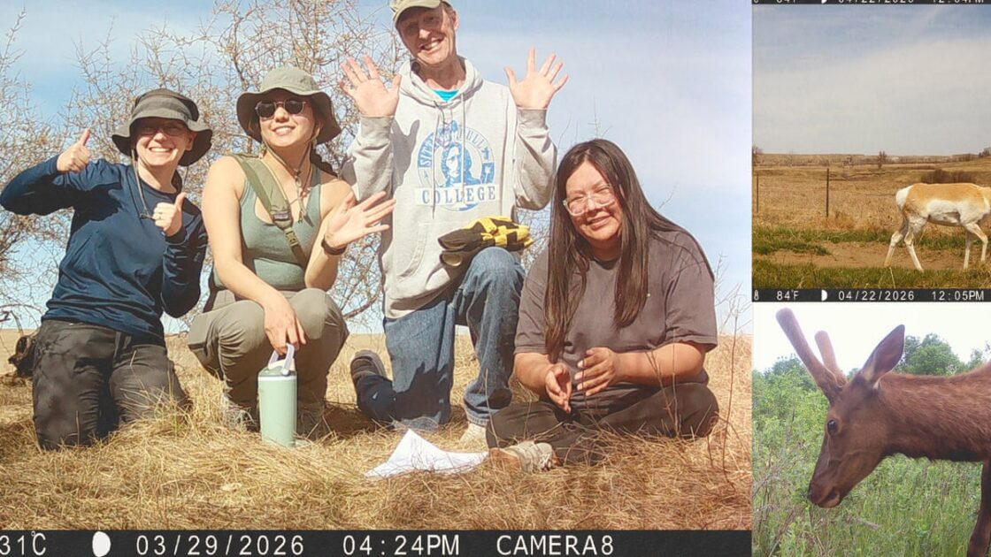
More than two centuries after Meriwether Lewis and William Clark mapped the American West, Indigenous students are participating in a new wildlife survey along the historic route. Partnering with the Smithsonian National Zoo and Conservation Biology Institute, students and faculty from tribal colleges are using motion-triggered trail cameras to document modern biodiversity.
Recording Wildlife and Honoring History
When President Thomas Jefferson sent out the Corps of Discovery in 1804, his main goal was political expansion, but he also instructed the team to document flora and fauna. While European Americans often view the expedition as a triumph, many Native Americans remember it as an invasion that preceded forced removal. Dan Buresh, a recently retired environmental science professor at Sitting Bull College on the Standing Rock Sioux reservation, noted the mixed feelings surrounding that history. Nevertheless, when he heard about the Smithsonian project, he wanted his students involved.
Project coordinator Brigit Rooney stated that the Smithsonian wanted to prioritize Native participation this time around to recognize the crucial contributions of tribal partners in navigation, diplomacy, and protection during the original journey. The Smithsonian’s Women’s Committee raised funds to provide paid internships for tribal students, making them the only re-survey volunteers to receive a stipend. Ultimately, seven tribal colleges joined the initiative to operate cameras, handle data, and interpret environmental changes on their reservations.
Initial hesitation existed among some Standing Rock residents concerned about outsiders accessing their lands or data being used to locate hunting spots. However, student intern Tamiera Garter and fellow student Precious Yellow Fat came to see contemporary data collection as essential for their community. Yellow Fat explained that the cameras provide vital insight for managing land and wildlife species, noting that protection requires visibility and understanding. Garter added that the effort ultimately supports tribal sovereignty and conservation autonomy.
Expanding the Snapshot USA Project
The re-survey received funding from the Smithsonian’s Our Shared Future initiative to mark the country’s semiquincentennial. Following the digitization of Lewis and Clark’s journals by Smithsonian staff, research partners activated camera arrays across the original route in spring 2026. Buresh, Yellow Fat, Garter, and other students installed 16 cameras across the 2.3-million-acre Standing Rock reservation.
Bill McShea, the Smithsonian wildlife ecologist who conceived the project, explained that the initiative stems from Snapshot USA, a nationwide mammal-monitoring program launched in 2019. Because the Great Plains lacked sufficient population density to provide adequate data for Snapshot USA, McShea saw the Lewis and Clark anniversary as an opportunity to fill those geographic gaps while highlighting tribal stewardship. Studies have consistently shown higher biodiversity on lands managed by Indigenous stewards, who oversee more land than the National Park Service.
Participating partners have captured more than 5.5 million images representing 67 confirmed species, including encouraging returns such as American beavers and fishers. Rooney highlighted that conservation stories often carry negative connotations, yet many positive developments emerged from the data. Following the final image captures, volunteers are currently identifying species from the uploaded files, with the Smithsonian planning to make the completed data freely accessible to the public, land managers, and scientists.